Quick answer: The core NEDD deliverable: visual evidence, observations, organized data, report-ready imagery, and decision-support language in one professional package. This service is built for clients who need something clearer than raw footage.
What this service is designed to solve
Clients usually do not need another folder of unexplained images. They need a record that helps them plan, prove, explain, price, repair, insure, monitor, or compare a site condition. This service turns capture into organized information with clear limits and a defined next step.
What can be included
- PDF report with purpose, scope, evidence summary, observations, limitations, and next step
- Organized photo and file folder
- Annotated visuals and condition notes
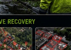
- Report-ready images for stakeholder communication
- AssetGuard pathway for monitoring when relevant
Professional boundaries
This deliverable documents visible and available evidence for planning, communication, and decision-support purposes. It does not replace licensed engineering, surveying, legal, code, insurance, or safety-critical review where required.
Best-fit packages
- Drone Data Report — standard report-first package.
- Technical Data Report — deeper documentation, maps, renders, and estimate-support detail.
- AssetGuard Intelligence Report — recurring records and monitoring-ready structure.