
Vermont Drone Data Services
Browse Vermont services by county, service type, and report deliverable. Each county page links into relevant services and the report request form.
Vermont Drone Data Services documentation built around usable records.
Vermont projects often need records that account for freeze-thaw movement, snow and ice, rural access, mountain weather, older buildings, lake exposure, and storm cleanup routes. NEDD does not deliver a unorganized photo set. The work is structured so owners, managers, contractors, carriers, and project teams can understand what was captured, what remains unknown, and what next step is most practical.
Site access, terrain, drainage paths, land features, structure locations, and map-style visual records.
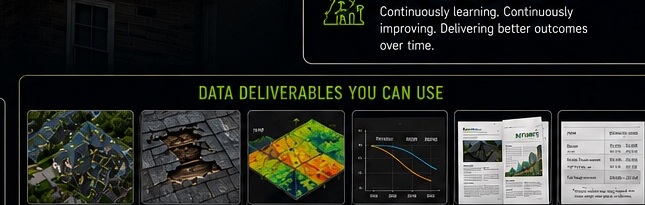
Downloadable files, annotated visuals, evidence folders, report notes, and context that stays tied to the captured record.
The record supports planning, maintenance, sale support, land management, access decisions, and future comparison.
NEDD provides documentation and decision-support records. Licensed engineering, legal, surveying, code, safety, or insurance determinations require the appropriate professional or authority.
Click a county to open the local service path.
County pages support local SEO, AI search, voice search, and buyer navigation while keeping the report-first CTA flow intact.
Addison County Drone Reports
Vermont county page for drone inspection, mapping, evidence folders, and reports.
View details →Bennington County Drone Reports
Vermont county page for drone inspection, mapping, evidence folders, and reports.
View details →Caledonia County Drone Reports
Vermont county page for drone inspection, mapping, evidence folders, and reports.
View details →Chittenden County Drone Reports
Vermont county page for drone inspection, mapping, evidence folders, and reports.
View details →Essex County Drone Reports
Vermont county page for drone inspection, mapping, evidence folders, and reports.
View details →Franklin County Drone Reports
Vermont county page for drone inspection, mapping, evidence folders, and reports.
View details →Grand Isle County Drone Reports
Vermont county page for drone inspection, mapping, evidence folders, and reports.
View details →Lamoille County Drone Reports
Vermont county page for drone inspection, mapping, evidence folders, and reports.
View details →Orange County Drone Reports
Vermont county page for drone inspection, mapping, evidence folders, and reports.
View details →Orleans County Drone Reports
Vermont county page for drone inspection, mapping, evidence folders, and reports.
View details →Rutland County Drone Reports
Vermont county page for drone inspection, mapping, evidence folders, and reports.
View details →Washington County Drone Reports
Vermont county page for drone inspection, mapping, evidence folders, and reports.
View details →Windham County Drone Reports
Vermont county page for drone inspection, mapping, evidence folders, and reports.
View details →Windsor County Drone Reports
Vermont county page for drone inspection, mapping, evidence folders, and reports.
View details →Choose the record that fits the decision.
NEDD helps organize visible evidence into files your team can use for repair planning, replacement decisions, claim communication, contractor coordination, budgeting, and future comparison.
Visible roof and exterior documentation before repair, replacement, or claim communication.
Storm / Fire / Loss RecordsOrganized post-event evidence before cleanup, contractor coordination, or claim discussions.
Repair or Replace SupportEvidence folders and estimate-support notes before major spend decisions.
Damage Over TimeBaseline records and follow-up captures for comparison over seasons, events, and repairs.
Construction ProgressMilestone, access, staging, and progress records for project communication.
Reports & DeliverablesReport packets, annotated imagery, map-style records, and evidence folders.
Drone surveying and aerial mapping support.
Start with the property or project decision. NEDD defines the capture, deliverables, repeatability, and professional limitations before the flight.