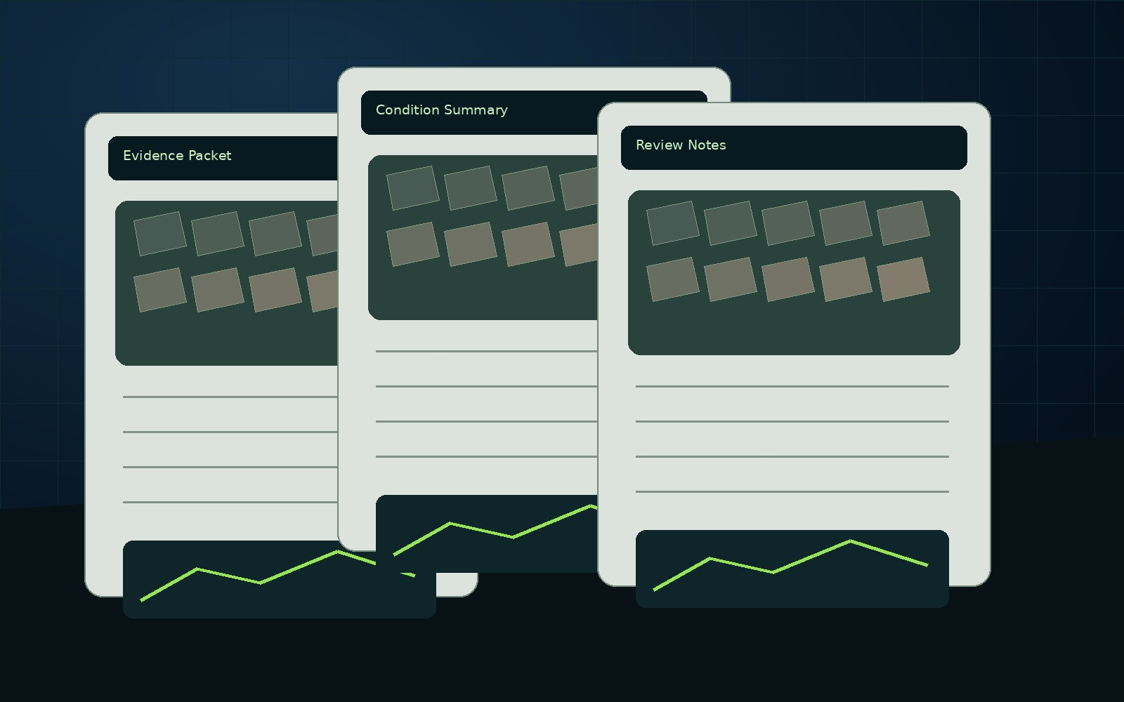
Report packets
Evidence folders, visual records, condition notes, and supporting references compiled into a usable package.
Inspection, mapping, technical reports, 3D renders, visual evidence folders, evaluations, estimate-support packages, and AssetGuard-powered intelligence records for property, construction, land, infrastructure, insurance, and municipal decisions.
 Part 107 WorkflowCommercial missions are planned around certificated remote pilot procedures, airspace checks, weather, and site permissions.
 Reports, Not File DumpsEvery package is built around what the client needs to decide, prove, compare, plan, or monitor.
 Privacy-First CaptureWe focus on the requested property and remove unrelated outside images during processing.
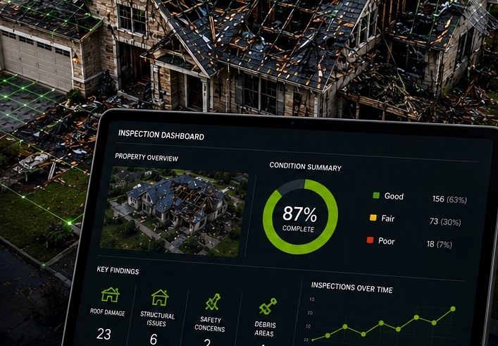 AssetGuard ReadyOne-time capture can become a baseline for future monitoring and organized asset history.
NEDD helps property owners, contractors, municipalities, and asset managers move from raw visual capture to repair-or-replace planning, claim communication, budget guidance, and damage-over-time monitoring.
Each page explains what NEDD documents, what files the client receives, how the record supports decisions, and how to request a documentation scope.
Inspection-support imagery organized into clear observations, evidence folders, maps, and report-ready documentation.
View details →Mapping-support imagery, orthomosaic-style records, access views, site context, and project documentation.
View details →The core NEDD product: visual evidence, observations, limitations, next steps, and a professional PDF-style structure.
View details →Presentation-ready renders, model-based visuals, overlays, and digital site records where capture conditions support them.
View details →Client-safe explanation of reference workflows used to organize repeatable capture and AssetGuard-ready records.
View details →Organized photo sets, report notes, date/context records, and deliverable packaging.
View details →Scope, access, constraints, risk, and budget-support context without replacing licensed professional review.
View details →Visible-condition review language using observed, unknown, and requires-review labels.
View details →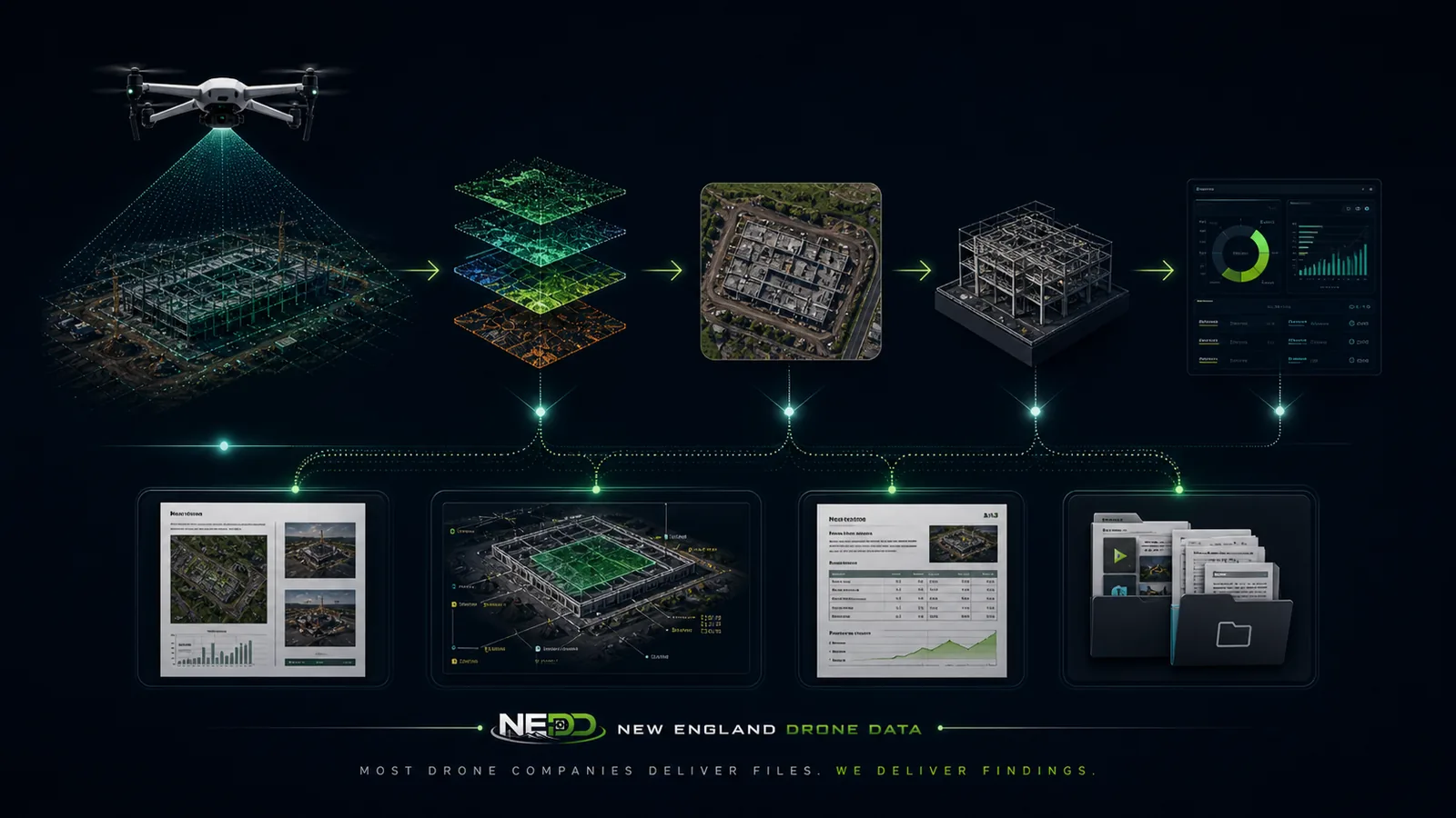
NEDD documents visible and available evidence so clients can plan, communicate, compare, escalate, or monitor with clearer records. Reports include limitations and professional-review triggers where engineering, legal, surveying, code, safety, or insurance determinations are required.
A clear comparison table for buyers deciding between raw imagery and structured deliverables.
View details →Capability-focused standards for resolution, mission planning, image handling, and professional boundaries.
View details →Public previews of anonymized report structures. Downloadable samples unlock after form submission.
View details →How project-focused capture, privacy, access, and unrelated-image removal are handled.
View details →Search and conversion pages are organized by industry so buyers can recognize their own problem quickly and move into the request form.
Roof, storm, exterior, drainage, land, and maintenance documentation.
View details →Recurring roof, exterior, parking, drainage, and portfolio documentation.
View details →Progress records, pre-cover documentation, site logistics, and dispute-prevention folders.
View details →Culverts, drainage, road washouts, facilities, roofs, storm response, and asset history.
View details →Storm evidence, before/after records, visible condition packages, and communication support.
View details →Terrain, access, boundary-visual, farm, forestry, sugarbush, and storm-damage records.
View details →Exterior assets, roofs, yards, silos, drainage, access routes, and recurring records.
View details →Aerial maps, visual overview records, land-sale documentation, and listing support.
View details →Start with a state hub, open a county page, then open the town page that matches the project location. Every location path connects back to services, pricing, sample reports, AssetGuard, and the request form.
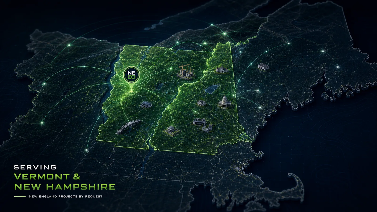
New England projects often need records that account for weather, access, repair planning, contractor coordination, budget timing, and future comparison needs. NEDD does not deliver a unorganized photo set. The work is structured so owners, managers, contractors, carriers, and project teams can understand what was captured, what remains unknown, and what next step is most practical.
Site access, terrain, drainage paths, land features, structure locations, and map-style visual records.
Downloadable files, annotated visuals, evidence folders, report notes, and context that stays tied to the captured record.
The record supports planning, maintenance, sale support, land management, access decisions, and future comparison.
NEDD provides documentation and decision-support records. Licensed engineering, legal, surveying, code, safety, or insurance determinations require the appropriate professional or authority.
Use the secure form to provide the property, asset, issue, timing, access notes, and desired deliverable. After submission, the direct project line and downloadable sample reports are revealed for follow-up.
NEDD organizes site capture around the files and documentation clients can actually use: repair planning, replacement decisions, storm and fire records, construction progress, mapping support, and future comparison.
Document visible roof and exterior conditions before repair, replacement, or claim communication.
Repair or Replace SupportUse organized visual records and estimate-support notes before committing budget.
Storm / Fire / Loss RecordsCreate clearer damage documentation before cleanup, contractor coordination, or claim discussions.
Damage Over TimeTurn the first capture into a baseline for seasonal, storm, or repair-performance comparison.
Construction ProgressKeep milestone, access, staging, and progress records organized for project communication.
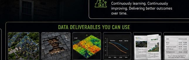
Reports & DeliverablesSee examples of report packets, annotated visuals, map-style records, and evidence folders.
NEDD helps organize visible evidence into files your team can use for repair planning, replacement decisions, claim communication, contractor coordination, budgeting, and future comparison.
Visible roof and exterior documentation before repair, replacement, or claim communication.
Storm / Fire / Loss RecordsOrganized post-event evidence before cleanup, contractor coordination, or claim discussions.
Repair or Replace SupportEvidence folders and estimate-support notes before major spend decisions.
Damage Over TimeBaseline records and follow-up captures for comparison over seasons, events, and repairs.
Construction ProgressMilestone, access, staging, and progress records for project communication.
Reports & DeliverablesReport packets, annotated imagery, map-style records, and evidence folders.
NEDD deliverables are organized to help teams review conditions, coordinate contractors, communicate clearly, and compare records over time.
Evidence folders, visual records, condition notes, and supporting references compiled into a usable package.
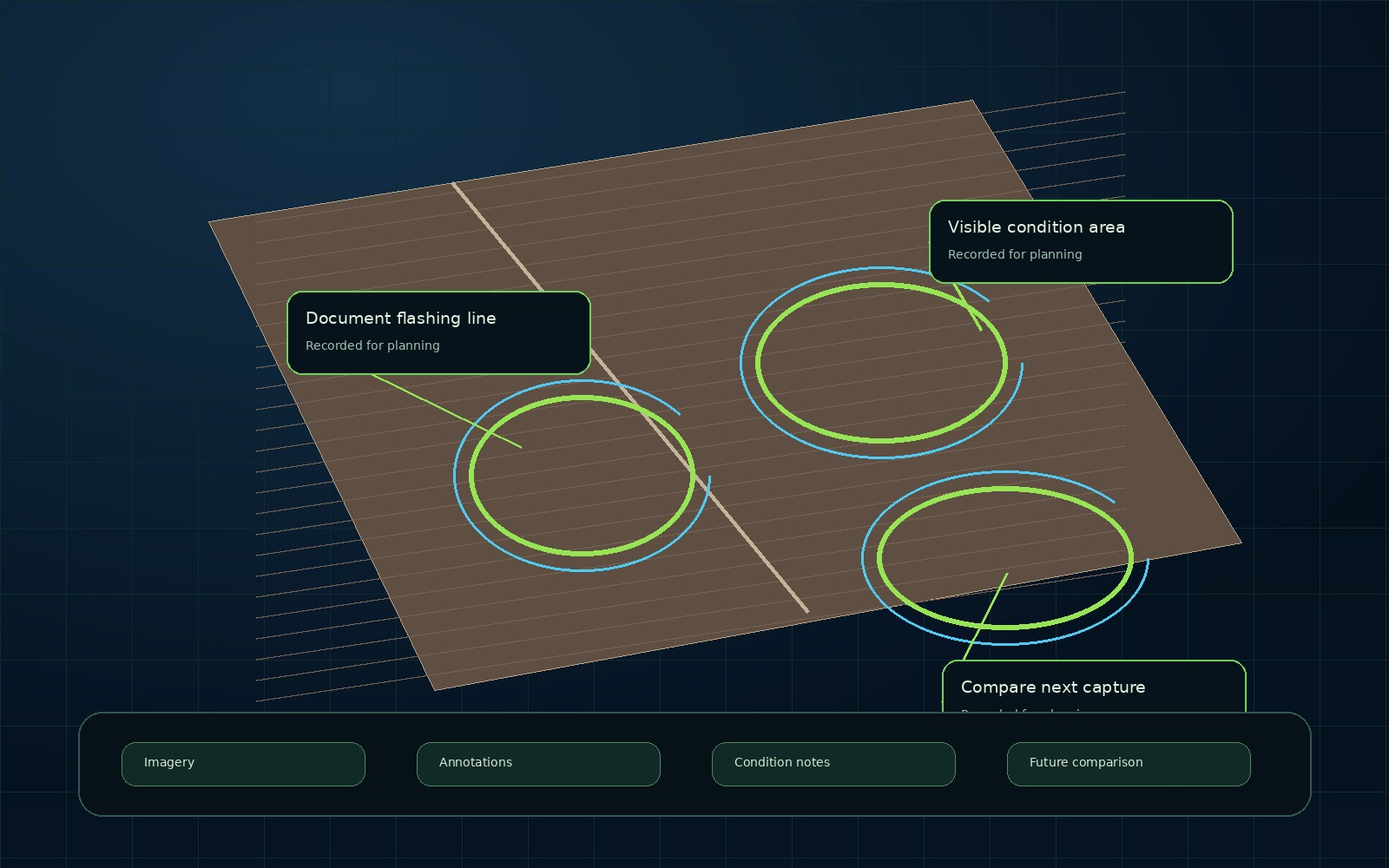
Images can be marked and organized so the visible condition is easier to review and discuss.
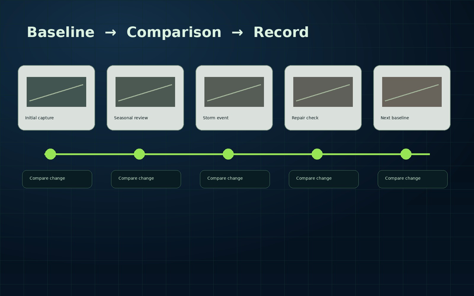
The first capture can become a baseline. Future captures help show what changed.
The process is built to reduce scattered photos, unclear records, and undocumented assumptions.
Collect aerial and ground visual evidence.
Sort files by condition, date, and purpose.
Separate visible evidence from assumptions.
Add planning context where applicable.
Provide files and report-ready records.
Support repair, replace, claim, budget, or coordination.
Use baseline records to track change.
Request a documentation scope for roof, storm, construction, land, municipal, commercial, or property records.
NEDD deliverables support planning and communication. Licensed review may still be required for engineering, legal, insurance, surveying, code, or safety-critical decisions.