Industry page

Insurance, Claims & Disputes Drone Data Reports

NEDD supports insurance, claims & disputes with evidence folders, before/after records, damage documentation, and claim-support reporting, delivered as clear reports, maps, evidence folders, 3D renders, evaluations, estimate-support packages, or AssetGuard-ready records.

Storm and fire loss documentation packet for organized visible evidence and recovery planning
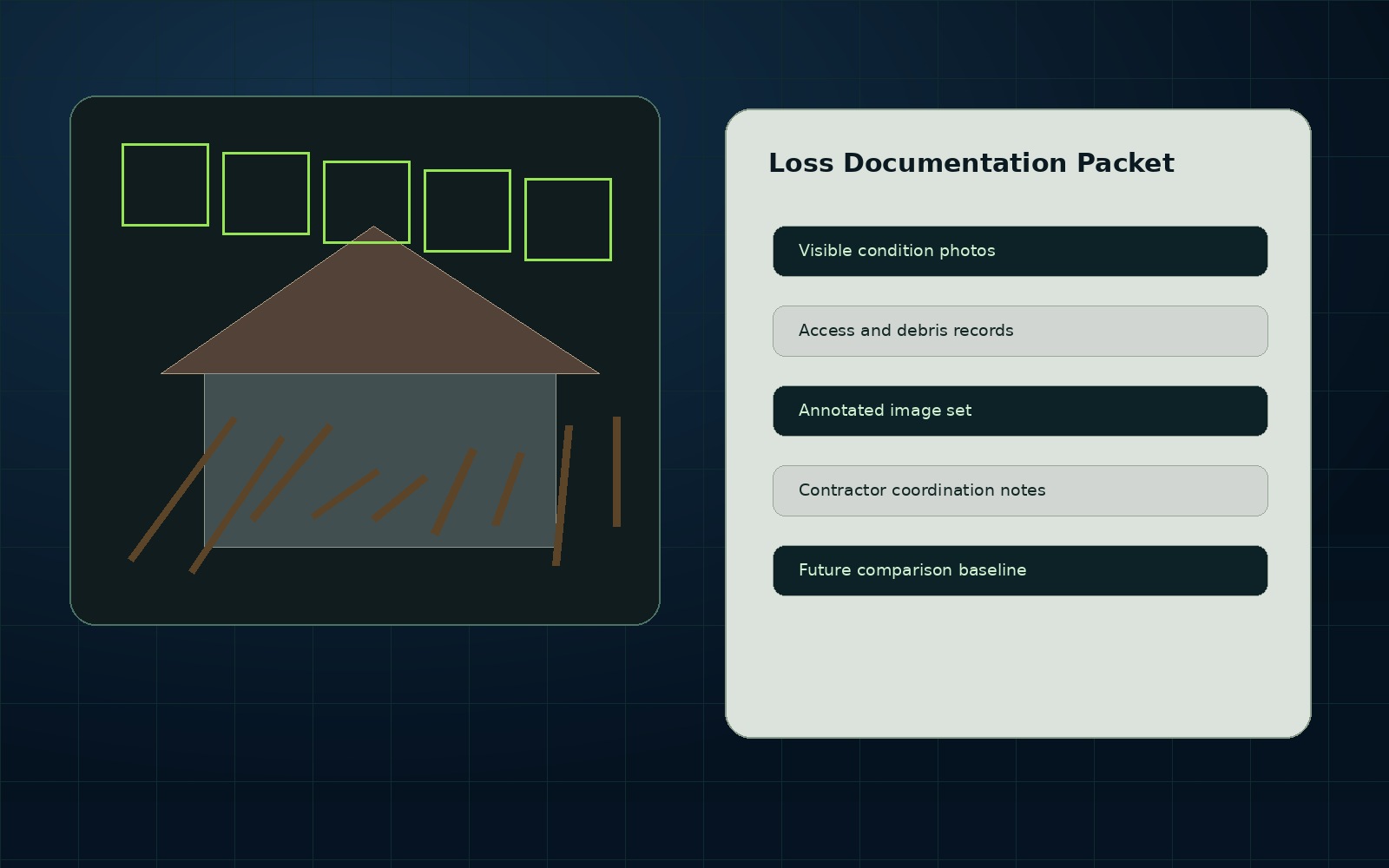
Quick answer: NEDD helps insurance, claims & disputes document assets clearly before deciding, repairing, disputing, budgeting, insuring, selling, or monitoring.

Best-fit deliverables

  • Drone Data Report
  • Technical Data Report
  • Visual Evidence Folder
  • 3D Render / Digital Site Record
  • Estimate-Support Package
  • AssetGuard Intelligence Report

What makes this scalable

Each request is packaged into repeatable service lines, with scope, deliverables, exclusions, travel/mobilization, and recurring-monitoring opportunities identified upfront.

Start with a report

Use the secure request form and select the industry or asset type that fits your project.

Request Scope
Structured storm documentation report preview for claim communication and recovery planning.
Insurance, Claims & Disputes Drone Data Reports: organized evidence, report files, and decision-support records.
Evidence-to-decision workflow

Insurance, Claims & Disputes Drone Data Reports documentation built around usable records.

New England projects often need records that account for weather, access, repair planning, contractor coordination, budget timing, and future comparison needs. NEDD does not deliver a unorganized photo set. The work is structured so owners, managers, contractors, carriers, and project teams can understand what was captured, what remains unknown, and what next step is most practical.

What NEDD documents

Visible damage, access limits, debris patterns, affected areas, and before/after context where available.

What the client receives

Downloadable files, annotated visuals, evidence folders, report notes, and context that stays tied to the captured record.

How it supports decisions

The record supports recovery planning, contractor coordination, claim communication, budgeting, and follow-up monitoring.

Professional boundary

NEDD provides documentation and decision-support records. Licensed engineering, legal, surveying, code, safety, or insurance determinations require the appropriate professional or authority.

Relevant services for Insurance, Claims & Disputes.

Industry pages connect buyers to the most useful service paths.

Drone-Enabled Documentation Reports

High-resolution visual capture organized into findings, reports, evidence folders, and next-step documentation for roofs, properties, infrastructure, land, and construction assets.

View details →

Aerial Mapping & Site Records

Mapping-support imagery, orthomosaic-style site records, access views, terrain documentation, and project maps for planning, communication, and future comparison.

View details →

Drone Data Reports

The core NEDD deliverable: visual evidence, observations, organized data, report-ready imagery, and decision-support language in one professional package.

View details →

3D Renders & Digital Site Records

Presentation-ready renders, model-based visualizations, map overlays, and digital site records produced from project-specific capture where appropriate.

View details →

Roof & Exterior Drone Reports

Roof and exterior documentation for storm evidence, commercial roof records, access limitations, drainage observations, rooftop units, and visible condition review.

View details →

Commercial Property Data Reports

Commercial property site documentation for roofs, exterior conditions, parking, drainage, access, maintenance planning, and recurring records.

View details →

Construction Drone Documentation

Progress reports, site records, pre-cover documentation, logistics views, staging records, and dispute-prevention documentation for contractors and owners.

View details →

Pre-Pour & Pre-Cover Documentation

Document what will be hidden before concrete placement, cover-up, burial, backfill, or build-out. Useful for future reference, dispute prevention, repairs, and owner records.

View details →

Infrastructure Visual Documentation

Inspection-support documentation for bridges, culverts, drainage, retaining walls, slopes, road-adjacent assets, public works assets, and exterior structures.

View details →

Municipal Asset Documentation

Town and public works documentation for culverts, drainage, road washouts, roofs, facilities, storm response, maintenance history, and budget planning.

View details →

Storm Damage & Insurance Evidence Folders

Structured documentation for storm damage, before/after conditions, repair planning, insurance-support communication, and dispute prevention.

View details →

Land, Forestry, Farm & Sugarbush Mapping

Terrain, access, boundary-visual, storm damage, forestry, sugarbush, farm, and land-condition mapping support without positioning drones as wildlife-harvest tools.

View details →