Belknap County local page

Center Harbor NH Drone Inspection, Mapping & Reports

Premium drone data reports for Center Harbor, NH: roof and exterior documentation, construction records, municipal assets, land mapping, storm evidence, 3D renders, estimate support, and AssetGuard-ready monitoring.

Quick answer: New England Drone Data serves Center Harbor, NH with report-first drone inspection, mapping, 3D renders, evidence folders, evaluations, estimate-support packages, and AssetGuard-ready records.

What clients in Center Harbor can request

  • Roof, exterior, commercial property, storm, and insurance-support documentation.
  • Construction progress records, pre-pour/pre-cover documentation, staging views, and contractor evidence folders.
  • Municipal/public works documentation for culverts, drainage, road washouts, facilities, and asset records.
  • Land, farm, forestry, sugarbush, access, and terrain documentation.
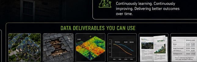
  • 3D renders, maps, visual evidence folders, and recurring AssetGuard monitoring where appropriate.

Local report boundary

NEDD documents visible and available evidence. Surveying, engineering, insurance coverage, legal, code, and safety-critical determinations require the appropriate licensed professional or authority.

Center Harbor report request

Use the secure form with the site address, asset type, deadline, and deliverable needed. After submission, the direct project line is revealed for optional follow-up.

Get Local Quote

Questions this page answers.

Written for human buyers, search engines, AI answers, and voice-search style questions.

Who provides drone inspection reports in Center Harbor, NH?

New England Drone Data provides drone inspection, mapping, reports, 3D renders, evidence folders, and AssetGuard-ready records for Center Harbor, NH when the scope, permissions, weather, and airspace requirements are workable.

Can NEDD document storm damage in Center Harbor?

Yes. Storm evidence folders can document visible site conditions, before/after records where available, and organized imagery for communication support. Insurance decisions remain with the carrier or appropriate professional.

Can NEDD create 3D renders or maps in Center Harbor?

Yes, when the site and capture conditions support it. 3D renders, map overlays, and digital site records are scoped based on the asset, site access, desired accuracy, and professional-boundary requirements.

Does NEDD show a phone number before submitting the form?

No. The website uses a secure form-first workflow. After the form is submitted, the thank-you page reveals the direct project line for optional follow-up.