New England Drone Data

Commercial Property Drone Reports

Commercial property drone reports can document roofs, drainage, parking, HVAC areas, facades, access, and recurring asset conditions.

Commercial Property Drone Reports NEDD site documentation hero visual
Quick answer: Commercial property drone reports can document roofs, drainage, parking, HVAC areas, facades, access, and recurring asset conditions. New England Drone Data focuses on usable deliverables, not basic drone media.

Why this matters

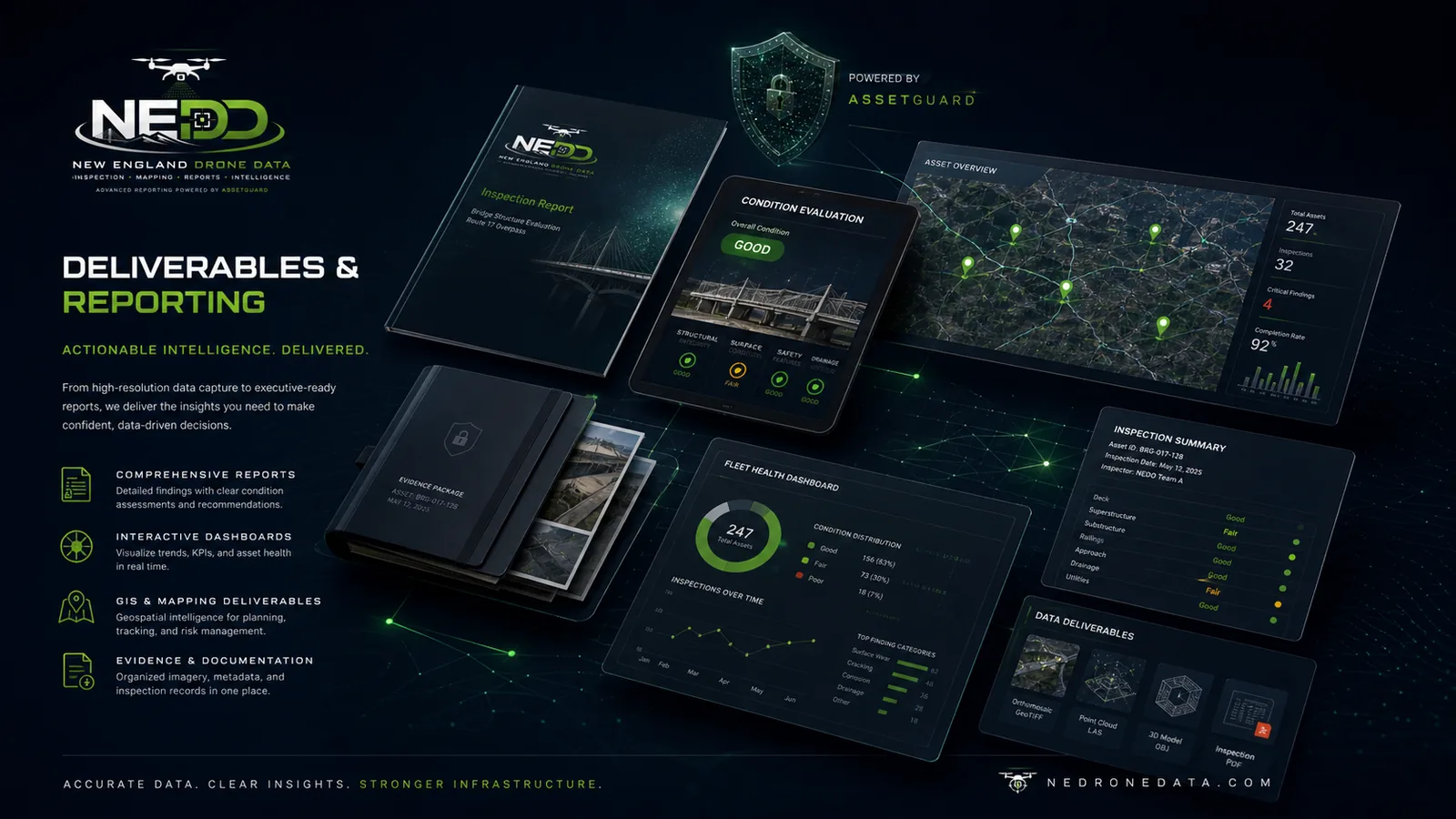
A flight alone rarely solves the client's problem. The value is created when capture becomes a report, map, evidence folder, evaluation, estimate-support package, render, or AssetGuard-powered record.

What a useful deliverable should include

  • Project-area focused capture.
  • Organized imagery and clear file structure.
  • Annotated visuals and summary notes.
  • Report language that identifies observations without overstating licensed engineering, legal, survey, or insurance decisions.
  • Optional AssetGuard record structure for recurring monitoring.

Who uses this

Property owners, commercial managers, contractors, developers, municipalities, insurers, attorneys, landowners, forestry operators, farms, and infrastructure teams use drone data when they need documentation that supports decisions.

Request a Related Report
Commercial Property Drone Reports visual
Commercial Property Drone Reports  evidence package, report files, and decision-support deliverable visual
Commercial Property Drone Reports: organized evidence, report files, and decision-support records.
Evidence-to-decision workflow

Commercial Property Drone Reports documentation built around usable records.

New England projects often need records that account for weather, access, repair planning, contractor coordination, budget timing, and future comparison needs. NEDD does not deliver a unorganized photo set. The work is structured so owners, managers, contractors, carriers, and project teams can understand what was captured, what remains unknown, and what next step is most practical.

What NEDD documents

Site access, terrain, drainage paths, land features, structure locations, and map-style visual records.

What the client receives

Downloadable files, annotated visuals, evidence folders, report notes, and context that stays tied to the captured record.

How it supports decisions

The record supports planning, maintenance, sale support, land management, access decisions, and future comparison.

Professional boundary

NEDD provides documentation and decision-support records. Licensed engineering, legal, surveying, code, safety, or insurance determinations require the appropriate professional or authority.

Questions this page answers.

Written for traditional search, AI search, and voice-search style questions.

What is the difference between drone photos and a drone data report?

Drone photos are raw files. A drone data report organizes capture into usable documentation, annotated visuals, condition notes, maps, findings, and next-step information.

Do you provide phone calls?

No phone-first workflow is offered. Project requests are handled through structured forms so site details, address, asset type, urgency, and deliverable requirements are documented before review.

Are reports engineering certifications?

No. Reports are decision-support and inspection-support documents unless otherwise stated. Engineering certification, structural design, code opinions, legal opinions, and insurance coverage decisions require the appropriate licensed professional or authority.