Apple Vision Pro-ready review

Review the property at spatial scale before you travel or commit.

Bring compatible panoramas, spatial photos and video, 3D models, Matterport tours, maps, and organized records into an Apple Vision Pro-ready review package.

Premium New England estate and real-estate property documentation from an elevated aerial view
Representative service visual. Final capture plan depends on the property, access, permissions, weather, safety, and requested deliverables.
Property marketing + spatial recordsShow the whole property, shorten remote review, and give buyers or stakeholders a clearer next step.
  • Clear written scope
  • Organized final files
  • Human-reviewed record
Request a Property Scope
Built around the decision

Give remote stakeholders a stronger sense of place.

A conventional PDF can explain a condition. A spatial review package helps stakeholders understand how rooms, structures, terrain, access, and visible issues relate to one another while keeping the source files and limitations organized.

What can be included

  • Vision Pro-ready panorama and spatial-media files where the selected capture method supports them
  • Compatible 3D model, USDZ, digital-twin, or Matterport review links where available
  • Side-by-side report, map, photo, and issue-reference windows
  • Guided review agenda with decision points, unknowns, and follow-up items
  • Optional live remote review session with the field record open
Best-fit clients

Buyers, owners, estates, construction teams, and remote decision-makers.

Best when the reviewer cannot travel, the property is large or complex, or multiple specialists need to understand the same record.

Popular combination: Matterport 3D tour + drone property overview + annotated report + guided Vision Pro review.

One coordinated record

Combine field capture, remote review, and organized delivery.

NEDD scopes each assignment around access, timing, permissions, weather, technology compatibility, the decision being made, and the people who need to review the result.

One-property spatial review pilot

Start with one property and one review decision.

Define the decision, agreed coverage, reviewer devices, source formats, and preferred handoff. NEDD confirms compatibility, access, capture methods, transfer or hosting requirements, and delivery in a written fixed-price scope before work is scheduled.

What to send for an accurate scope.

  • Property or project location, approximate size, and access contact
  • The specific areas, assets, concerns, or features to document
  • Who will attend remotely and what device or review format they prefer
  • Required date, urgency, recurring schedule, and desired deliverables
  • Any available listing, plan, inspection, claim, contractor, or prior-condition records

Apple Vision Pro can display windows, panoramas, spatial photos and video, and compatible 3D content. Exact presentation depends on the current visionOS version, Safari or native-app support, source format, and the client’s installed applications. Apple and Apple Vision Pro are trademarks of Apple Inc.; references do not imply endorsement.

Professional boundary: Spatial review is documentation and communication support. It does not replace an in-person inspection or licensed professional determination when either is required.

Representative 3D twin examples

See what a decision-ready digital property record can look like.

Match the capture method to the decision: Matterport for intuitive walkthroughs, drone photogrammetry for exterior and terrain context, LiDAR for spatial detail, and repeat capture for progress or condition comparison.
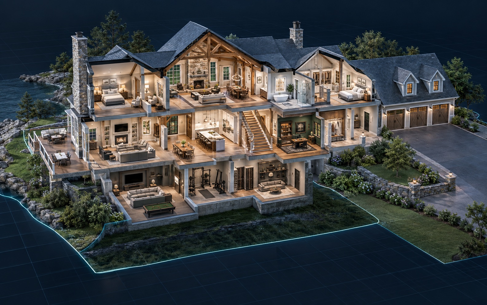
Illustrative residential estate digital twin with a navigable dollhouse cutaway and surrounding property context
Residential + estates

Room-to-roof property twin

Combine an immersive interior record with exterior context so buyers, owners, estates, and remote reviewers can understand layout before deciding where deeper diligence is needed.

Explore Matterport capture →
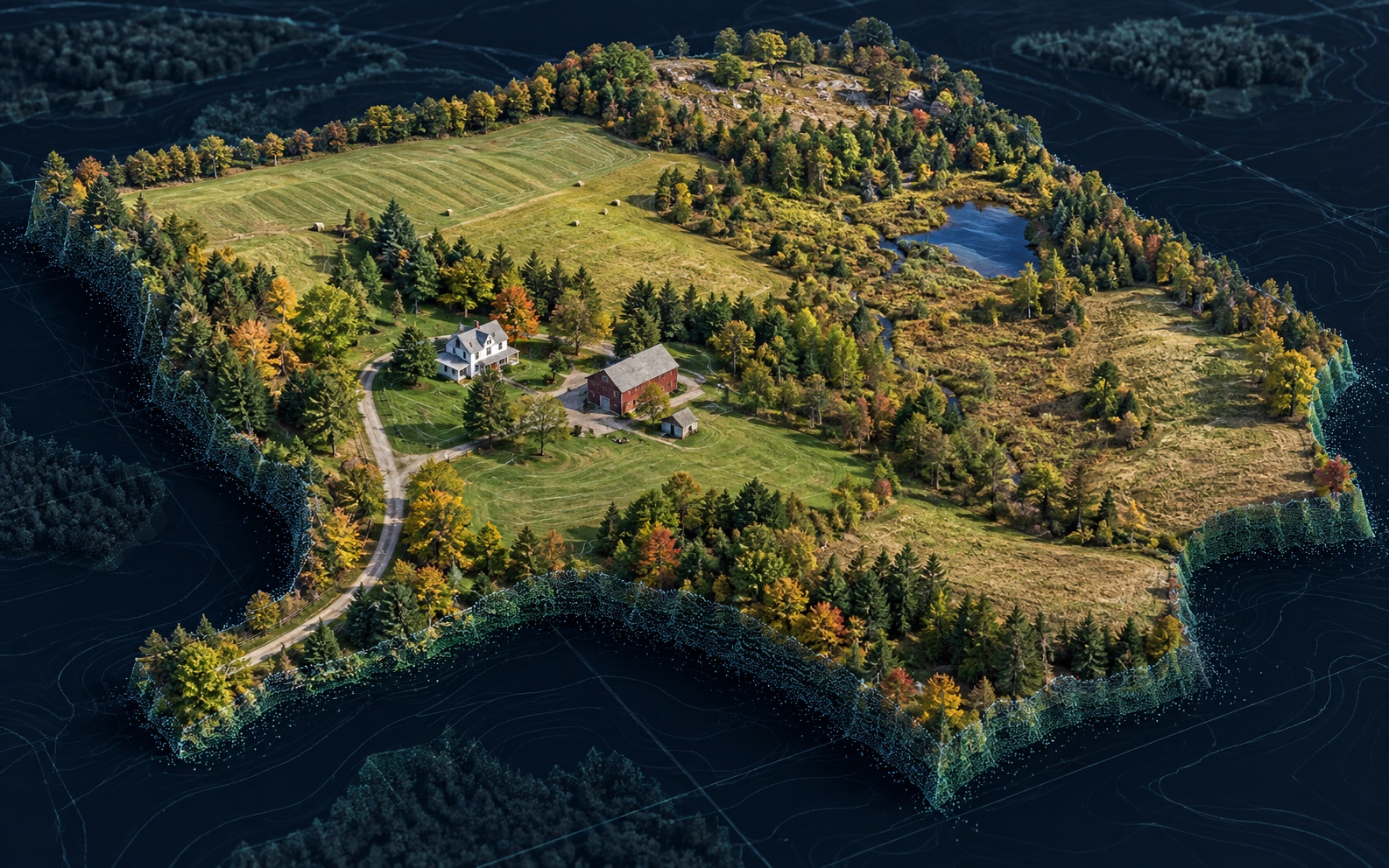
Illustrative drone-derived three-dimensional terrain model of a large New England rural property
Land + large properties

Aerial terrain and site twin

Bring structures, access, terrain, fields, vegetation, drainage, and other visible site context into one reviewable model for planning and repeat monitoring.

Explore large-property records →
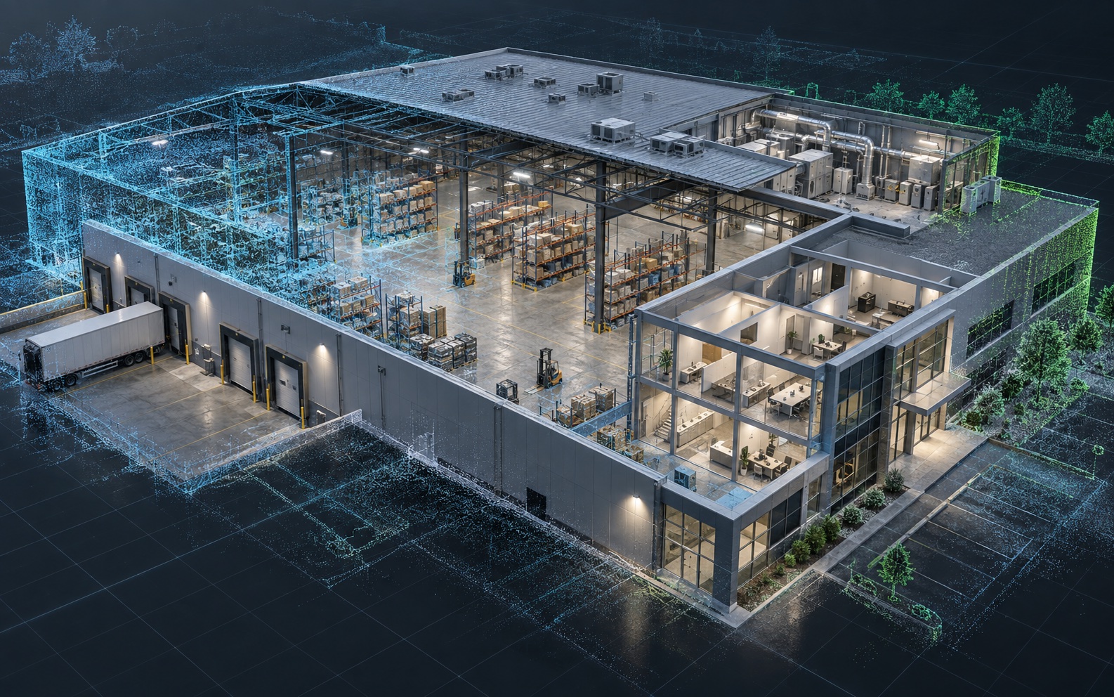
Illustrative commercial facility digital twin combining a building cutaway with LiDAR-style point-cloud context
Commercial + facilities

Facility and asset twin

Connect rooms, roofs, equipment zones, loading areas, visible conditions, and reference points for handoff, maintenance, renovation, or portfolio review.

Explore spatial twin review →
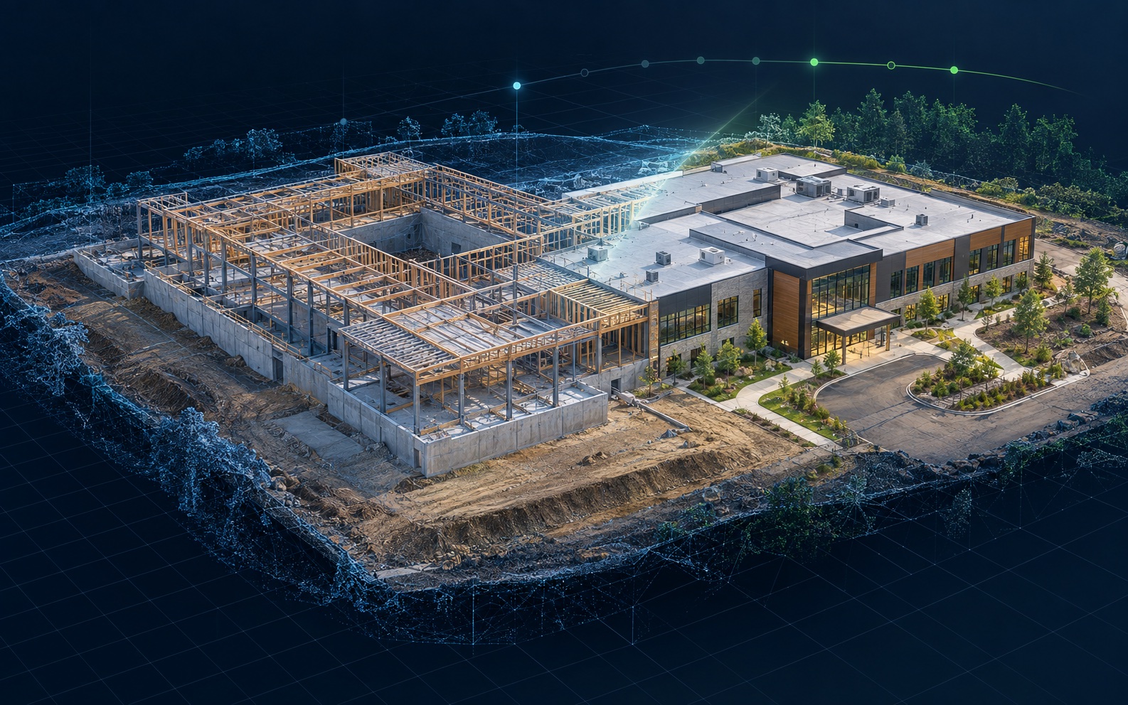
Illustrative construction digital twin showing coordinated early and later building milestones
Construction + progress

Milestone comparison twin

Preserve the same site at agreed milestones so remote owners and project teams can revisit visible progress, access, staging, concealed work, and open questions.

Explore progress twins →
Built for the way your team reviews property

Scope the useful record first—then select the capture stack.

NEDD can combine Matterport, drone imagery, photogrammetry, LiDAR, thermal documentation, ground photography, maps, and guided remote review around the property and decision.

Example-use disclosure: These are illustrative concept renders, not completed NEDD client projects, survey-grade datasets, architectural records, engineering models, or promises of a specific deliverable. Final appearance, coverage, accuracy, compatibility, hosting, and file formats depend on the property, capture conditions, permissions, selected technology, intended use, and written scope.